Ride Information
- Distance 70 miles (112km)
- Climbing 1752m (5790ft)
- Grade Difficult
- Duration 4-8 hours
- Maps OS Landranger 196 The Solent & Isle of Wight
- Download the route here
There’s something very appealing about the Isle of Wight in the autumn. The buckets and spades have been put away until spring, the beaches are almost empty, and the sea breezes put colour in your cheeks. It’s a great time to go riding, too. The roads are refreshingly free of nose-to-tail tourist traffic and there’s still enough light for a long day ride.
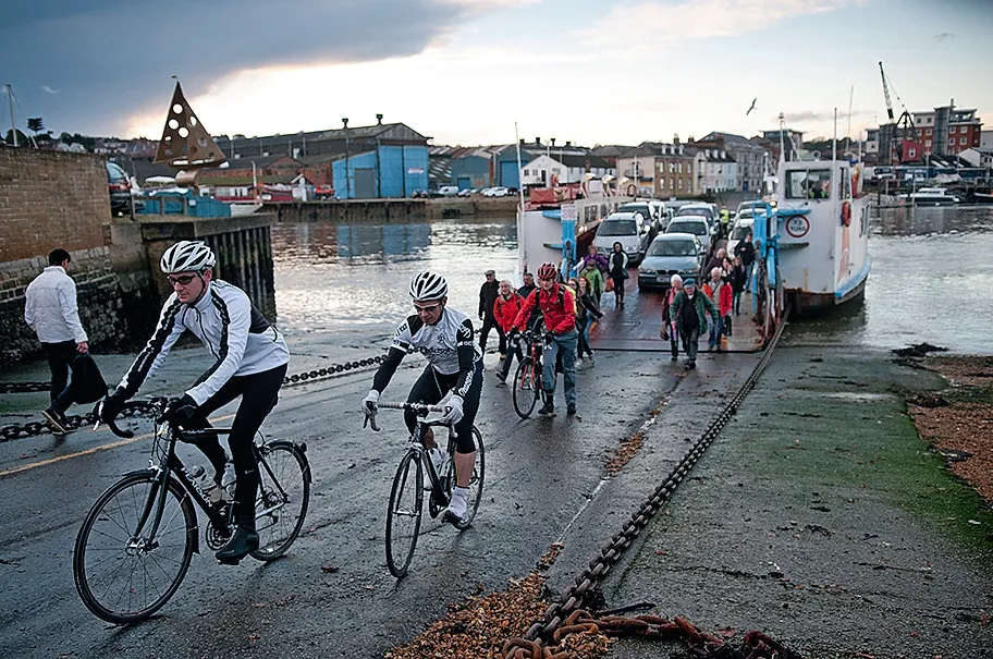
That’s the theory at least. When we wake up in Ryde on the island’s north east coast it’s raining heavily. The weather forecast is promising better conditions from mid-morning. We’ll see.
After a tasty and calorific hotel breakfast we roll out of town and begin our island circuit. It’s as good a place as any to start, not least because the Portsmouth ferry arrives here. There’s a pleasantly relaxed feel to the town, with its cafes, delis and curio shops. The Victorian architecture is just what you’d expect of a seaside resort – elegant and just the right side of faded.
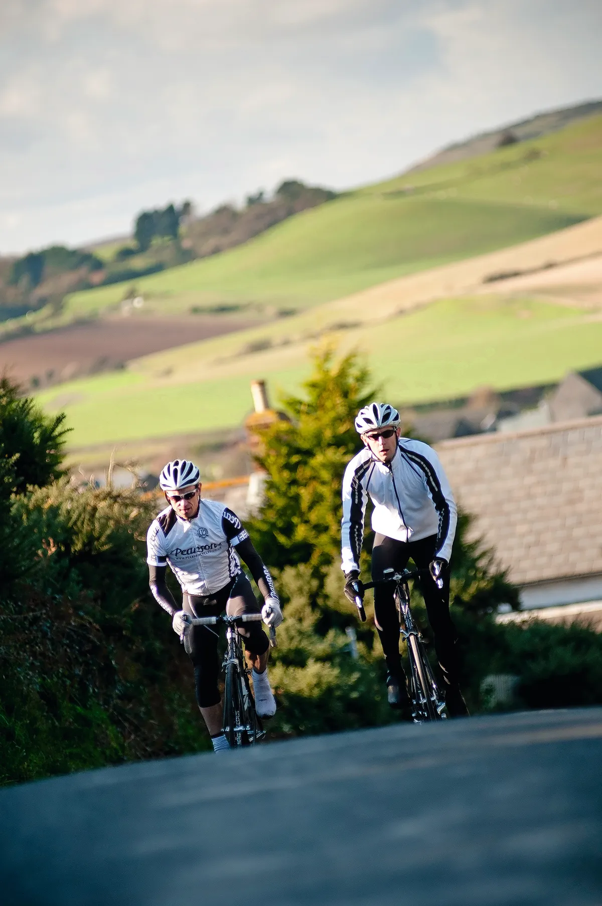
The rain has stopped now and the sun is showing through broken clouds as we make our way along the Esplanade. There’s barely enough time to get the legs warm before the road ramps up for the day’s first climb. It’s not especially long or steep but it’s enough to have me huffing and puffing. Guy from Pearson Cycles rides off ahead and eases up so I can catch up at the top.
We soon turn off the A3055, one of the island’s bigger roads, and head towards Bembridge on the B3330. These first few miles set the pattern for the day: restlessly climbing or descending, the road seemingly never content to stay flat unless we’re a pebble’s throw from the sea. The island’s highest point, St Boniface Down, stands at only 240m, but it’s clear we’re not going to have an easy day, especially with the stiff headwind that’s blowing from the south.
At the top of the climbs there are clear views over the Solent towards Portsmouth and the spectacular 170-metre-tall Spinnaker Tower – and the brooding dark clouds which I’m hoping are now behind us, literally and figuratively.
TOUCH OF WIND
We lose all our hard-earned height descending from St Helens to Bembridge Harbour. Bembridge used to be cut off from the rest of the island by a strip of water before land was reclaimed from the sea in the mid-1800s. We cycle past a long line of houseboats before climbing up towards the village itself, home to the island’s only windmill.
The mill hasn’t been used for almost 100 years but if it was working today the sails would be turning at quite a rate. We’re sheltered from the wind for a while as the road rolls through a wood but we hit the breeze again by Bembridge Airport. There’s no sign of any take-offs or landings today. A pilot would have their work cut out with the wind blowing hard across the runway. The airfield pub looks inviting, and we do stop to look over the old anti-aircraft gun in the car park, but with another 60 miles or so still to ride, we soon get back in the saddle.
The next descent is the best of the day so far, dropping down to the sea at Sandown. Even into the wind this is a fast stretch of road, and we stop again to enjoy the views of Sandown Bay with Horse Ledge cliff in the distance.
We climb out of town, then amble through Shanklin’s guest houses, hotels and B&Bs. Almost every building in town seems to be connected to tourism. Although we’re now back on the A3055, traffic is light enough to lean the bikes hard left then right for an S-bend on the edge of town. We make the most of our momentum as the road climbs again.
SILLY MOO
The staccato rhythm of climb and descend, climb and descend is interrupted by a proper hill, easily the longest we’ve ridden so far. Guy rides off ahead and I’m left to wonder why my summer fitness seems to have flown south for the winter. I misread the road sign for ‘Cowleaze Hill’ as ‘Cowsleaze’ and take my mind off how stiff my legs feel by imagining all kinds of bovine scandal all the way to the top, where Guy has had enough time to dismount and take a picture.
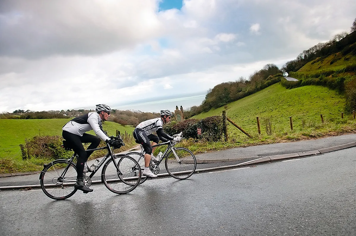
It is beautiful up here, though, and the next few miles to Ventnor are the most enjoyable yet. I’m determined to put in a shift on the front as the road sweeps, twists and turns its way along the hillside.
As the main road drops steeply towards the centre of Ventnor and the sea, we turn right in search of some more short, sharp, chevron-marked climbing. After another leg tester, we run along the top of the cliff for a while, looking south to see nothing but wind-whipped waves all the way to France. An inland excursion briefly reminds us that the wind is the cyclist’s friend as well as foe, before we turn west and back towards Niton. We rejoin the A3055, sit back in the saddle and find a steady rhythm for the climb up the chalk downs to St Catherine’s Hill. Thankfully the road curves around one shoulder of the hill rather than climbing to the top, as the summit is only a little lower than St Boniface Down.
The reward for several minutes’ hard work at the chalk-face is a helter-skelter downhill. We haul on the brakes for the roundabout at Blackgang Chine theme park, where I spent several happy days on family holidays in the ’80s. We’re not stopping, though – this descent is better than any fairground ride.
A sharp right-hand bend puts an end to our gravity-assisted speed, but not the daft grins on our faces. We’re back on minor roads again, winding our way through small villages on lumpy roads which have us constantly shifting gear and in and out of the saddle. The south of the island feels very different to the busier, more populous north, with beautiful views towards the cliffs at Freshwater to make up for struggling into a wind which seems to be blowing us backwards whatever direction we head in.
We plug on, past the pretty Elizabethan manor house at Mottistone, teeth gritted on every exposed section of road, before turning south and returning to the sea.
NEEDLES POINT
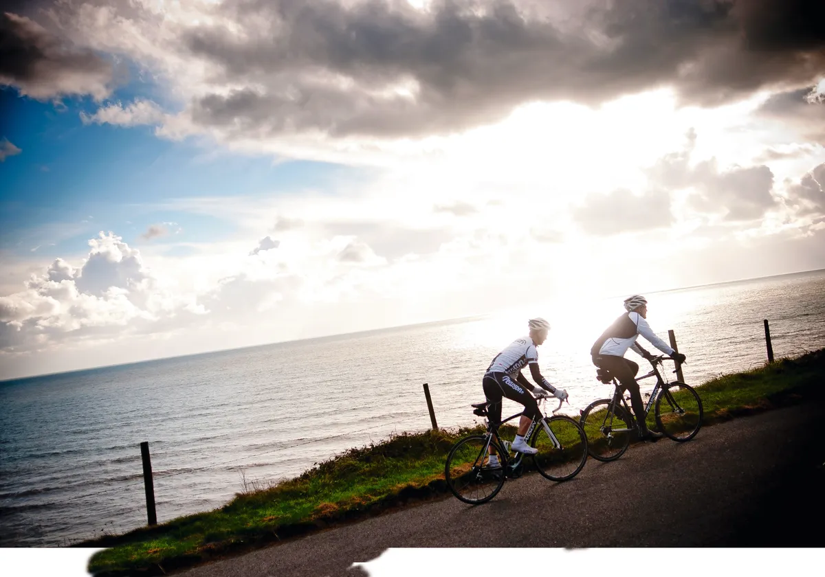
The next few miles are a rollercoaster ride along the cliff edge. Provoked by some less than complimentary comments about my lack of fitness, I put in a long stint on the front, with Guy sheltering from the wind behind me and off to one side, a two-man echelon leaning into the wind to keep a straight course. From high on the cliff top, we drop down fast to the sea at Freshwater Bay, then swing inland towards The Needles, the westernmost point on the island. We enjoy some shelter for a while, running along the foot of the hill in the shadow of the Tennyson Monument, a huge granite cross in the poet’s honour.
It’s a little disappointing that the road runs out so soon. We can see the chalky columns of The Needles a little further west, but to get closer we’d need to travel on foot. We’d also have liked to visit the Needles Batteries up on the cliff, where Black Knight rockets were test-fired back in the ’50s. Maybe next time. For now, we’re both running on empty and ready for a plate of carbs with a carb chaser.
Faces stuffed and bellies filled at The Needles Park in Alum Bay, we get back on the road. Normally I feel sluggish after a big mid-ride lunch, but today I’m refreshed and ready to pick up the pace. A sparrowhawk circles overhead as we climb back up the hill, and watches our progress for a while as we head northeast. I’m surprised to see how close the coast of the New Forest is, and now we’re sheltered from the wind the Solent could be mistaken for a lake compared with the choppy waves and bluster on the south side of the island.
We make our way inland again, away from the main road from Yarmouth to Cowes and onto minor roads again. At the foot of Bowcombe Down we swing north, and for the next few miles enjoy a tailwind so strong it’s like facing backwards in a wind tunnel. It feels good to stick the bike in the big ring and leave it there for a while. Even the climbs on this stretch feel easy compared with what’s gone before.
There are some short, sharp hills to deal with as we approach Cowes, though, and I feel like I’ve burned through the last of our carbohydrate binge at The Needles. We jump on the ferry across to East Cowes – free for bikes – and roll out past Queen Victoria’s holiday home at Osborne House. As soon as we can, we leave the main road behind and follow narrow rolling lanes all the way back to Ryde.
The light is fading as we arrive. Even without the wind, this would have been a tougher ride than I’d expected. Leave the bucket and spade at home, but make sure you pack your best cycling legs.
LOCAL KNOWLEDGE
Nearest ferries
It’s a circular ride, so start at Ryde, Cowes, Fishbourne or Yarmouth www.wightlink.co.uk, www.redfunnel.co.uk
Food & drink
There are plenty of shops, cafes and pubs throughout the ride. We stopped for lunch at The Needles Park www.theneedles.co.uk
Where to stay
It’s a holiday hotspot. Take a look on the Isle of Wight Council’s website www.iwight.com/visitors
Bike shops
Try the TAV Cycles in Ryde, just around the corner from the start/finish
To subscribe to Cycling Plus, get more great rides, and take advantage of our current free gift, head here.