Ride Information
- Distance 88 miles (142km)
- Climbing 1045m (3428ft)
- Grade Hard
- Duration 6-10 hours
- Maps OS Landranger 186 Aldershot and Guildford, 187 Dorking and Reigate, 186 Aldershot and Guildford, 198 Brighton and Lewes
- Download the route here
Roadies, are you getting tired of riding the same old routes? Well, why not add a bit of off-road spice to your normal cycling mix?
Starting and finishing from St Martha’s Hill just outside of Guildford in Surrey, it heads south to the coast off-road, where you can stop for ice cream on the beach in Brighton, then turns north, flip-flopping between road and trail on the way.
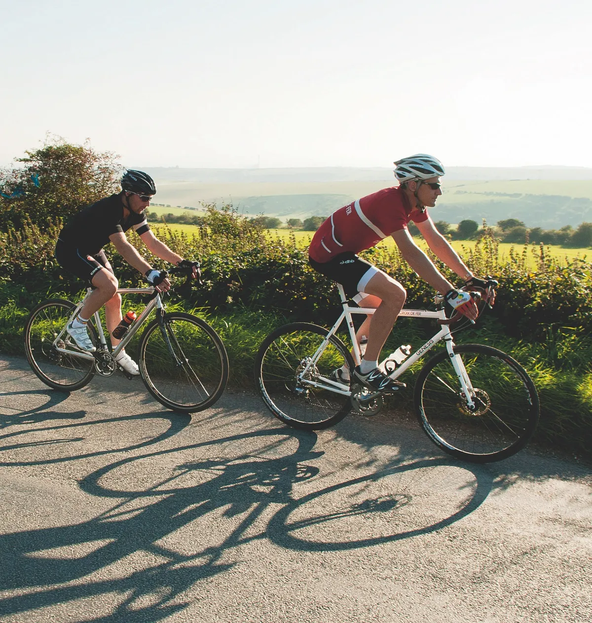
It’s an early morning in late September when riding partner Mike and I get ready to ride. By rights we should be in long sleeves and three-quarter shorts, but we’ve lucked out with one of the hottest days of an Indian Summer. Our gilets can stay in the car.
The first 37 miles are on the Downs Link. As the name implies, the trail links the North and South Downs, running from St Martha’s Hill down to Shoreham.
Much of the ride follows disused railway lines, so we've been expecting some pretty straightforward riding and are rather surprised to find that the first few miles are anything but. The trail out of the car park is thick sand, churned up by dozens of horses’ hooves. Our bikes slip and slide like broken shopping trolleys, and not for the last time I raise an eyebrow at Mike’s decision to ride in road shoes and pedals.
FEEL THE BUZZ
The tricky riding over the lumps and bumps of the North Downs does prove a point, though. Five inches of suspension travel would squash most of these roots and bumps flat, but with cyclocross tyres and rigid forks, our pupils are wide with concentration. The bikes are up to the job, but only if the rider is, too.
True to form, I get distracted and almost ride into a tree as we cross Blackheath. Much of this part of Surrey was once heathland, and some of the trees have been felled to restore the old habitat. A legion of spiders has spun webs in the gorse bushes, and they’re glistening with dew in the morning sun.
As the ride goes on the ground gets less sandy, and our confidence levels rise. I’m really enjoying the descent to the Wey and Arun Canal, right up until the moment I swallow an insect the size of a small bird. Mike thinks he can still hear it buzzing as we cross the bridge over the canal and turn left toward Bramley.
In half a mile or so we reach the village, riding through the old station complete with platforms, signals and old-fashioned level crossing barriers.
We shift into the big ring and build up some speed towards Cranleigh. The next few miles are almost dead straight, continuing to follow the route of the Horsham and Guildford Direct Railway. For a while there’s almost nobody around, then we can tell we’re getting close to Cranleigh when the dog walkers and joggers start to outnumber the rabbits darting in and out of the hedgerows.
From Cranleigh, the Downs Link continues south east towards Horsham. There’s more evidence of the trail’s steam-driven past in the form of a restored station building at Baynards. It looks like a set from a period drama, but is actually a railway enthusiast’s home.
LET’S GET TECHNICAL
Just south of here the riding gets more technical. The trail doubles back on itself after crossing under a road, and Mike and I scrabble for grip on a steep and gravelly climb. Stand up to get power to the pedals and our back wheels spin; sit down and the tyres bite but it’s tough to get enough leverage through the pedals.
After a sharp left turn at the top there’s the best downhill of the day so far, fast and well surfaced. This time we both get to the bottom without ingesting any winged energy food.
A little further on there’s a brief on-road section, before trail takes over from tarmac at Christ’s Hospital School. We’re soon back in peaceful woodland, riding through a tunnel of green. We only really realise how much cooler it is in the shade of the trees when we emerge into the sunshine. The hedgerows are thick with the last of the summer blackberries, and the strong sun has us sweating all the way to Henfield.
We’re making good time until we come across a herd of cows, almost blocking the trail. They ignore us, far more interested in chewing the cud, and we’re forced to gingerly ride around the bovine blockage before getting back up to speed.
From Henfield, we start to get a clear view of the South Downs, silhouetted against a cloudless blue sky. A lumpier few miles bring us to the floodplains of the River Adur. The imposing shape of Lancing College Chapel, all flying buttresses and gothic excess, is getting ever closer.
A bridge takes us across the river where we have the option of taking the South Downs Way towards Eastbourne. Instead, we follow the course of the river for its final mile or two to the sea.
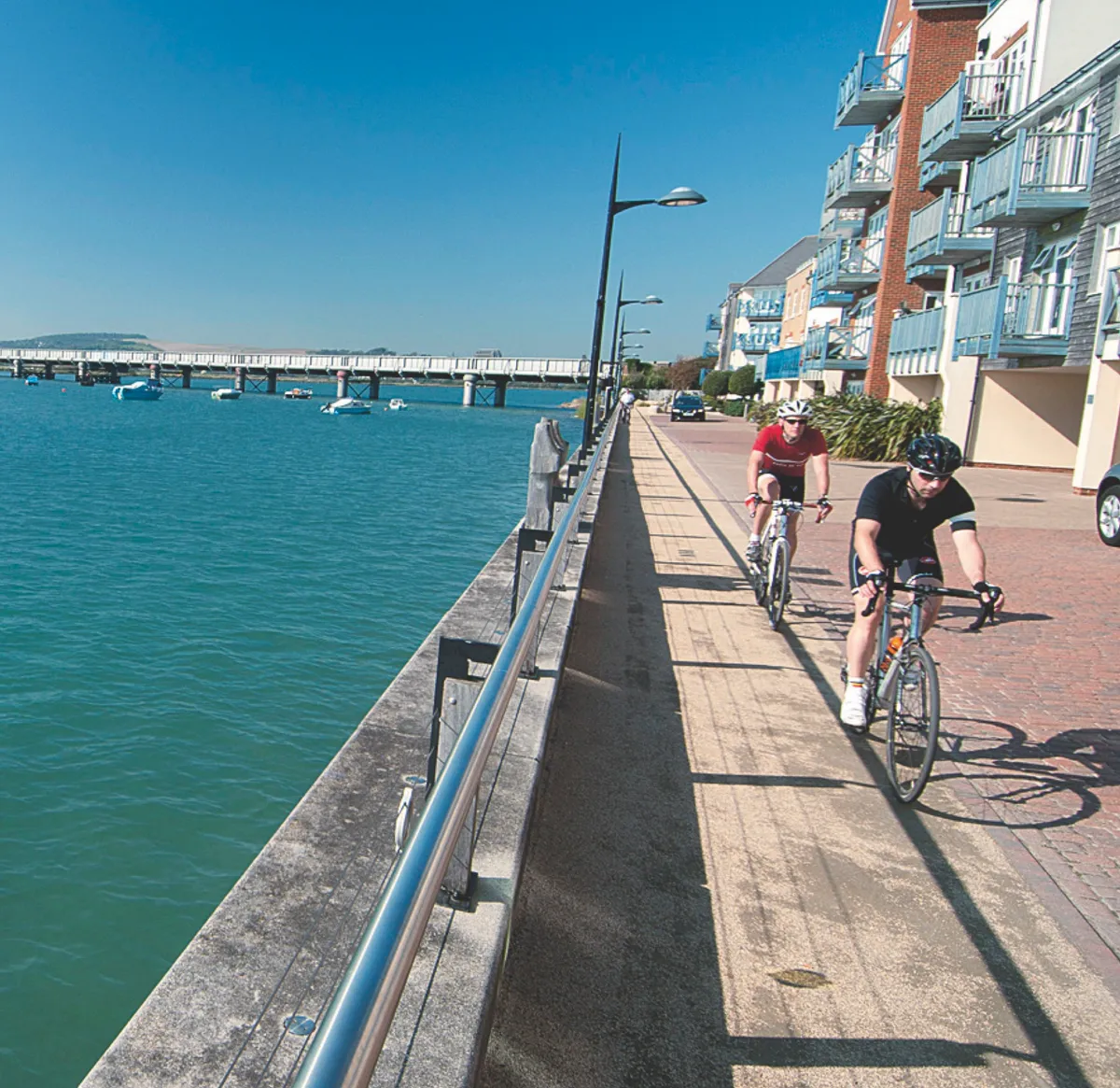
Small boats bob gently in the water as we reach Shoreham and the end of the Downs Link trail. Although we’ve only covered 37 miles it’s now early afternoon and our planned seaside lunch is overdue, so we pick up the pace along the coast road towards Hove.
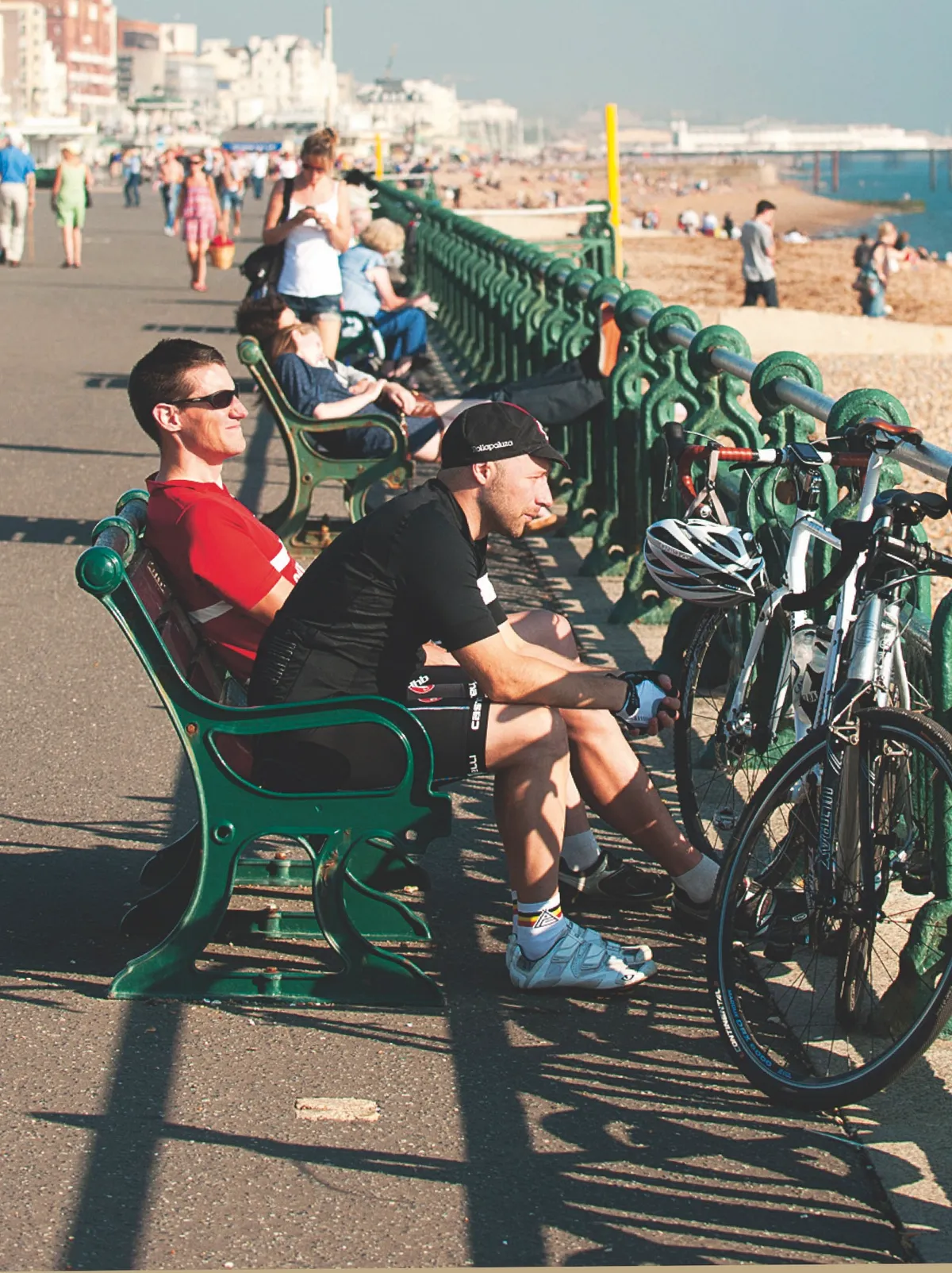
We’re not the only ones taking advantage of the unseasonably warm weather. It could be a summer weekend, not mid-week in autumn, judging by the numbers on the beach enjoying the sun. We leave our bikes outside The Lawns Café, order jacket potatoes and mugs of hot coffee, and swap cycling for people-watching for a while. Refreshed and refuelled, we spin along the seafront to Brighton. The pier looks busy as we turn left and head inland, cycling past the shoppers and al fresco diners.
We leave the town behind and climb Devil’s Dyke. It’s a lot easier than its neighbour, Ditchling Beacon, especially from the town side, but it’s still a long climb and marks the ride’s highest point. I’d planned to ride the Dyke on the road, but we can’t resist a quick off-road blast along the South Downs Way as we get near the top.
HAVING A BLAST
The road down the other side of Devil’s Dyke is the best descent of the day. Mike and I put our bikes in top gear and are still spinning out, so we tuck in low and let gravity do the work for us. At the bottom of the hill it’s time to play roadie, taking turns on the front and keeping the pace high as we ride past freshly harvested fields and autumn-tinged woodland.
The ’cross bikes make a decent fist of fast road riding on flat or downhill sections, their knobbly tyres humming contentedly. It’s only on the climbs that they seem significantly slower than a pure road bike.
A couple of bridleway sections break up the ride back, taking us on shortcuts that would shred road bike tyres in a few yards. Each off-road cut-through puts a dent in our average speed but adds spice to the heat of the day, as well as a layer of fresh dirt to Mike’s pristine white road shoes.
By now the sun is getting low in the sky, but the temperature remains stubbornly high. We push the pace as West Sussex becomes Surrey, and stay in the big ring to keep pace with the four-wheeled commuters on Cranleigh High Street. In Shamley Green the pub beer garden is full to bursting.
A GRAND DAY OUT
A cold beer sounds like a good idea, but the Surrey Hills haven’t finished with us yet. We’ve still got to cross the same hills we struggled over this morning. Riding them on tarmac should be easier than struggling with slippery sand, but with 80 miles in our legs the lactate soon builds.
The sun is low in the sky as we reach Chilworth. We can see the church at the top of St Martha’s Hill, picked out by the soft evening sunlight. A left turn puts us on Guildford Lane for one last push to the top of the hill and home.
This ride has a bit of everything. On the right bike it doesn’t matter if you’re riding tarmac or trail, so long as you can’t wipe the grin off your face.
LOCAL KNOWLEDGE
Nearest station
Chilworth station, if you’re beginning from St Martha’s Hill. www.nationalrail.co.uk
Food and drink
There are a number of pubs and cafes along the route. We stopped at The Lawns Cafe on the seafront in Hove. Its opening hours depend on the time of year – and the weather.
Where to stay
There’s no shortage of B&Bs, hotels and campsites on or near the route. Try visitsurrey.com and lovesussex.com for more details.
Bike shops
There are several bike shops in Guildford, just around the corner from St Martha’s Hill. Try Cycleworks on London Road (www.cycleworks.co.uk). At the far end of the Downs Link there’s a Giant Concept Store in Shoreham (www.giant-shoreham.com), and there’s also Freedom Bikes in Brighton (www.freedombikes.co.uk).