Ride Information
- Distance 112km (70 miles)
- Climbing 510m (1952ft)
- Descent 640m (2100ft)
- Grade Medium
- Duration 5 hours
- Maps OS Landranger 172 Bristol & Bath, 173 Swindon & Devizes
- Download the route here
"Why?" is all I can think as we strain out of the saddle up the third 20 per cent incline since I led us on this ‘shortcut’ from Bradford on Avon to Bath. Trust me to add an uphill to what should, by definition, be a downhill ride. We’re following a river from its source to the sea, and as water doesn’t flow uphill, there shouldn’t be any climbing.
The idea was simple: ride the length of the River Avon that runs through Cycling Plus's home town of Bristol, from its source in Gloucestershire, to where it flows into the Severn Estuary at Avonmouth. As the crow flies it’s only 19 miles, but by following the river through the ancient villages, towns and settlements along its path, it’s a 70-mile meandering ride from the Cotswolds to the Severn. All downhill… in theory.
Our journey starts in Acton Turville, which is sandwiched between the M4 motorway and Badminton Park of horse trials fame. There’s no real sign of the Avon yet as it plays hide and seek with the nearby London-Bristol railway line, and it’s not until we reach Luckington, the next village a couple of miles to the north-east, that it starts to resemble a river. In fact, just past Luckington Court there’s a ford through the river on the back road to Sherston, the next town. It’s cobbled and deep, though, so if you don’t fancy wet feet, there’s a raised footpath too.
Just out of Luckington there are signs of the first great road builders, the Romans, as the arrow-straight Fosse Way cuts across our path. Further north and south it’s a modern road, but here it’s no more than an overgrown trail marked by little wooden signs.
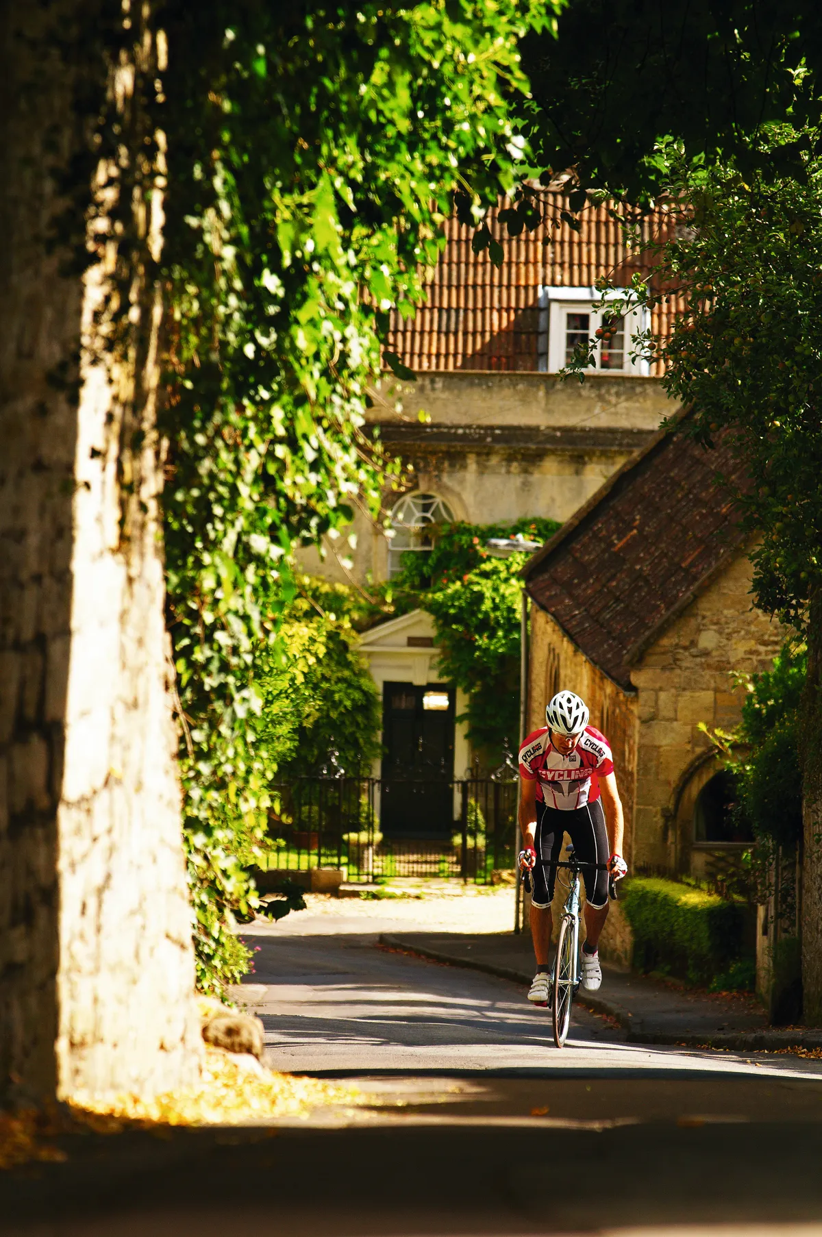
Soon the hilltop town of Malmesbury comes into view. It claims to be the oldest continually inhabited town in England, and a short out-of-the-saddle honk up to the hilltop goes some way to explaining why. With steep slopes on all sides and a natural moat of two converging tributaries of the River Avon almost surrounding it, the town must have been easy to defend. Much of the spectacularly buttressed abbey still stands, and can be seen from miles away. The thriving tourist industry also means plenty of cafes.
All caked up, we roll through town and past one of its few mills. Malmesbury’s hostile geography also isolated it from the industrial revolution that enriched the neighbouring towns connected by canals and railways. Leaving town we finally start following the river south out of the Cotswolds and onto the plain of Dauntsey Vale towards Chippenham.
GO WITH THE FLOW
The riding is flat now, with the odd glimpse of the Marlborough Downs far off in the distance as we pass through Great Somerford which, like so many of the towns and villages on this ride, came into existence simply at a river crossing. Tranquil farmland stretches out on both sides – until we duck under the M4 – but its thundering noise overhead is soon forgotten as we ride back into the cosy countryside again.
Chippenham is the biggest town so far, but with its heavy traffic and new commuter neighbourhoods we’re happier to leave than arrive, and push on south towards the much more charming Lacock. The picturesque Cotswold village is almost entirely National Trust owned, and with its ancient abbey – and the filming of the blockbusting Harry Potter movies there – it’s firmly on the tourist trail.
As we ride through the village we catch glimpses of the abbey, whose grounds our river runs through, the imposing wooded slopes of Bowden Park providing a magical backdrop. Just past the abbey we turn to cross the valley, the slopes of Bowden Hill ahead now positively threatening. Thankfully, just before the hill starts in earnest, we turn south towards our next river crossing at Melksham.
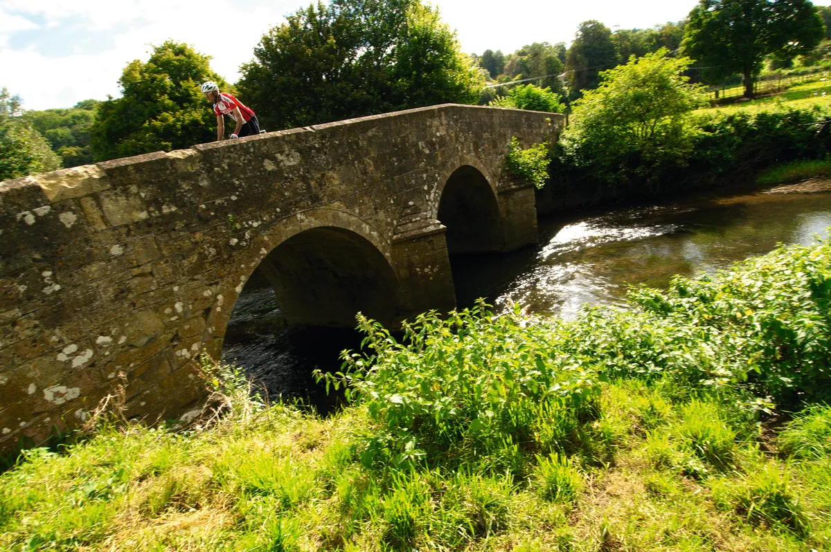
Following signs to Bradford on Avon, we cut through the north of town and cross the river on a long stone-ballustraded bridge. A few miles and quaint villages later we’re descending into Bradford, past the Moulton bike factory where small-wheeled bikes are still made.
Where originally there was a ‘broad ford’ crossing point, we cross the Norman bridge, with its small lock-up on one end. Bradford isn’t big, but it’s certainly grand, with the most impressive buildings built in the 17th century textile boom when some 30-odd wool mills saw fortunes made here.
Armed with take-away sandwiches, cakes and coffees, we stop in a shady little park by the bridge. It’s an idyllic setting with the midday sun filtering through the trees; the sea seems a world away and we’ve still got to navigate our way through Bath and Bristol.
TAKE THE HIGH ROAD
It’s at this point that my brain seems to misfire – probably the midday sun – telling me we should try riding directly to Bath as the crow flies, avoiding a detour as the river dog-legs north-east then south-west again to Bath. My logic is that we’ll also be able to avoid the choice between the busy A36 or a loose-surfaced canal towpath that might mess up our road bikes.
We cross over the Kennet and Avon canal – spurning the path that could lead us on the level all the way to Bath – then turn up a small lane towards Avoncliff. If we’d seen the writing on the wall it would have said 20 per cent – and we’d have bailed out…
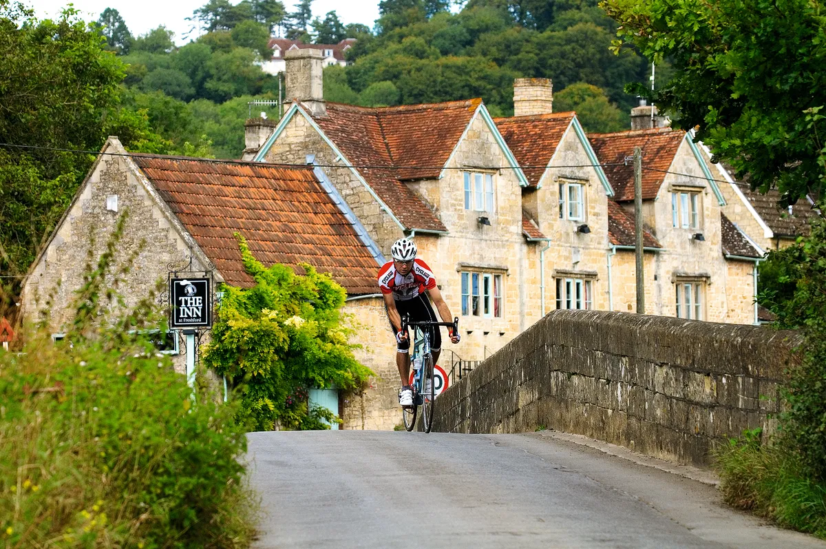
But no. On we push through the lanes towards Freshford, hoping to contour along above the river… We’re wrong, and after a cracking descent through fast, tight lanes, between dry-stone stone walls and high hedges, we finally pop out on an open valley floor. There ahead is another delightful bridge with Freshford village beyond. Only this is the River Frome, which flows into the Avon a bit further down. We’ve just lost all that hard-won altitude, and okay, we had fun losing it, but now we’ve got to go and win it back all over again.
Freshford is like a bijoux Bradford – the same style of 17th century opulence – but much smaller. Sadly this doesn’t also apply to the killer climb up through the village to the A36. Ten minutes of granny gear grinding later and we’re at the main road and faced with a choice: keep climbing and continue the roller-coaster ‘shortcut’, or admit the error and turn right down the main road to follow the Avon into Bath.
We turn right and the payback is a glorious flat-out A-road descent through the woods high above the Avon, bringing us, eyes streaming and hearts pounding, to the Viaduct Inn. It’s worth a diversion to the canal here, even if you’re not going to take the path all the way to Bath, to see the 140-metre-long Dundas Aqueduct.

Worried about time – and our bikes’ paintwork – we shun the gravel path and get back on the draggy A36, knuckling down to some serious through and off. As we enter the outskirts of the city the road tilts down again and we have to check our pace as the city traffic builds.
We turn down Great Pulteney Street, with its tall, elegant Bath stone townhouses, to the iconic bridge of the same name We turn down Great Pulteney Street, with tall, elegant Bath stone townhouses lining the street to the iconic bridge of the same name. With shops on both sides and the Avon below, this is one of Bath’s most famous landmarks, and even more impressive in the flesh, with the water roaring over the weir.
TIME FOR A BATH
We head towards the station, shadowing the river, and pass Bath Abbey, the other side of which are the Roman Baths and Pump Room. Bath really is a lovely place to stop, but our home town of Bristol is about 17 miles away, and then there’s still another five or so to the coast, so we keep going.

Just opposite the station is where the Kennet and Avon canal finally joins the Avon, which is navigable from here all the way to Avonmouth. Bored of city traffic, we roll onto the paved path that runs alongside the Avon here, just after the station, and follow it all the way to the Locksbrook Inn in western Bath. Another half a mile of proper road and we join Sustrans’ Bristol & Bath Railway path.
This flat, paved, traffic-free, 17-mile route between the two city centres was Sustrans’ first major project and a huge success, with over 3000 bike journeys a day in summer. Today, though, we’ve got it largely to ourselves, with the river constantly zig-zagging across our path.
Just short of Bitton station, where steam trains still run, we bid farewell to the river for now as our path arcs north to enter Bristol through the city’s northeastern suburbs. Until now the path has been a rural idyll, but even in the city its cuttings and tunnels take us down a traffic-free, practically uninterrupted green corridor of relative calm all the way to the centre of Bristol.
GORGE YOURSELF
We follow signs for Bristol Temple Meads station, which sits between the start of Bristol’s floating harbour – where a constant level of water is maintained by lock gates – and the New Cut, a man-made channel with the now tidal Avon. This channel is our guide as we head for the Avon Gorge, past signs for the fantastically restored SS Great Britain, to Bristol lock.
Bristol lock is like any other, only much bigger, with tides of up to 9.5 metres rising and falling on the gorge side, and the whole of Bristol’s floating harbour on the other. It’s quite a thrill to wheel our bikes across the top of it, with regency terraces lining the hillside up to Bristol’s exclusive Clifton village ahead, and Brunel’s stunning suspension bridge topping it all, 75m above the gorge.
Minutes later we’re riding below the bridge, with the Avon – now a huge tidal river – on our left. It’s a spectacular way to leave Bristol, as we follow the A4 Portway to the equally impressive, though considerably less picturesque, M5 motorway bridge to Avonmouth.
Finally we arrive, with the acres of new cars, big cranes and wind turbines marking the thriving ports of Avonmouth and Royal Portbury Dock. The latter is where almost a third of the nation’s new cars arrive on container ships. Avonmouth’s not much of a tourist trap – and you’re more likely to find a greasy spoon here than a skinny latte – but the modern docks are a fittingly industrial finale for a river journey that has taken us from the Roman roads of the Cotswolds via the mills and milestones of the Industrial Revolution to the age of the car – by bike.
LOCAL KNOWLEDGE
Nearest station
Chippenham near the start, and Avonmouth at the finish www.nationalrail.co.uk
Food and drink
Almost all the villages and towns that the ride passes through have pubs, and of course Bath and Bristol have a huge choice. Also try the following: the Lock Inn in Bradford on Avon for good canalside beers, food and even bike hire (www.thelockinn.co.uk), the Buffet cafe at Bitton Station, where you can eat in an antique railway carriage (www.avonvalleyrailway.org), and the Cottage Inn on Baltic Wharf, Bristol.
Where to stay
See each area’s official tourist information site: www.visitwiltshire.co.uk, www.visitsomerset.co.uk, www.visitbath.co.uk and www.visitbristol.co.uk
Bike shops
Cycology Bikes, Chippenham; Cadence, Bath; TT Cycles, Bradford on Avon; Mud Dock Cycleworks, Bristol
Images: Seb Rogers